
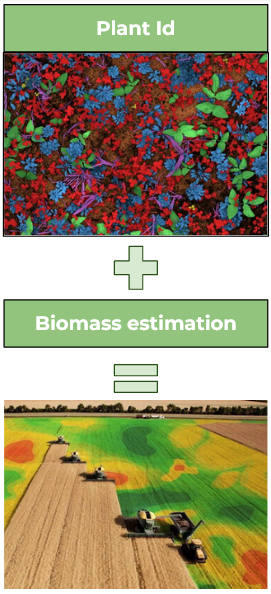
Plant Mapping
Building a better view of crop fields
[old: Technology to support crop success]
What is plant mapping?
Plant mapping allows growers to gather detailed, reliable information about their fields quickly and accurately. This technology combines image collection with artificial intelligence (AI) to generate high-resolution field maps showing cash crop, cover crop, and weed species, density, and biomass. These maps can offer insight into topics such as weed resistance, water stress, and drought tolerance and inform decision making regarding nitrogen fertilization rates, weed management strategies, and cover cropping.
For a detailed description of plant mapping watch this 28-minute video, which describes field-scale mapping of crops and weeds using high-resolution color images and AI.
Precision Sustainable Agriculture is currently offering and refining multiple plant mapping systems.
PlantMap3D
Farmers need to know the biomass and density of cash crops, cover crops, and weeds in order to make effective real-time decisions and to plan for the future. But collecting plant samples and drying and weighing them is time-consuming, and the resulting information is limited by sample numbers and locations. The Precision Sustainable Agriculture team has combined new imaging technology with artificial intelligence (AI) to create a more efficient and effective way to identify and estimate the biomass of cash crops, cover crops, and weeds.
PlantMap3D uses inexpensive, off-the-shelf camera technology and open-source software to generate maps of plant species, their biomass, and their density in real time. PlantMap3D data can help farmers with many management decisions. Knowing the biomass of their legume cover crops, for example, helps determine how much nitrogen is available so farmers may adjust fertilization accordingly. Likewise, knowing a field’s weed species distribution and their biomass can inform more customized and efficient weed management plans.
PlantMap3D collects RGB (color) images and grayscale stereo images taken by multiple-lens cameras that capture how far the plant is from the camera. These depth data allow PlantMap3D to estimate biomass. PSA open-source software automates data acquisition, analysis, and visualization.
This video explains how a stereo camera works.
Precision Sustainable Agriculture offers three types of PlantMap3D:
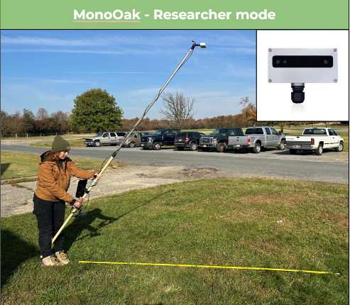
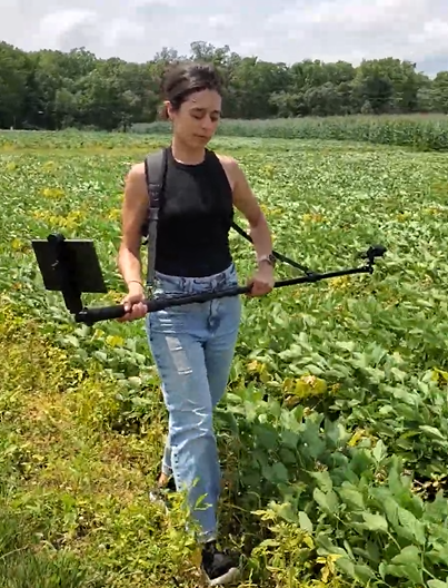
1. The MonoOak is a hand-held stereo and RGB camera system ideal for researchers, farmers, agricultural consultants, and Extension agents studying small plots.
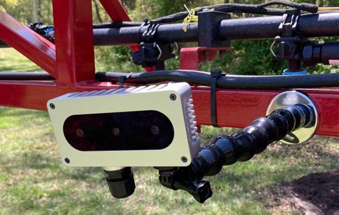
2. The MultiOak is a system of two to eight stereo and RGB cameras that can be mounted on a tractor or sprayer boom. It’s ideal for farmers and agricultural consultants studying big production fields.
3. The MonoPro is a hand-held video camera that takes footage of plants for 3D reconstruction.
Learn more about PlantMap3D and its development at Confluence.Building an Agricultural Image Repository
The Precision Sustainable Agriculture team is building the Agricultural Image Repository, a cloud-based bank of tens of thousands of high-resolution images of cash crops, weeds, and cover crops, as well as layers of metadata that describe them. PSA uses these images and metadata to build sensors and tools that help farmers throughout the U.S. make real-time, data-driven management decisions to maximize yield and better respond to weeds, insects, and diseases.
Learn more about the Agricultural Image Repository and it’s development at Confluence.BenchBot
A technology the PSA team developed for populating the National Agricultural Image Repository is BenchBot (BBot). It’s an automated, high-throughput, relatively low-cost modular system that collects high-resolution plant images quickly and reliably, indoors and out.
Composed of open-source hardware and software, BBot has a mobile, robotic, aluminum frame that holds cameras, lighting, sensors, and computer equipment and is positioned over the growing area. It moves autonomously down a row of plants, collecting images and other data and sending them to the National Agricultural Image Repository’s computer vision pipeline, where they’re processed and annotated semi-automatically.
PSA staff are currently using BBot to collect thousands of images of cash crops, cover crops, and weeds in a semi-field environment (potted plants kept outdoors) from seedling stage to approximately 15.7 inches (40 cm) tall.
Watch this short video to learn about the technology and science behind BBot.
Learn more about BenchBot and its development at Confluence and GitHub.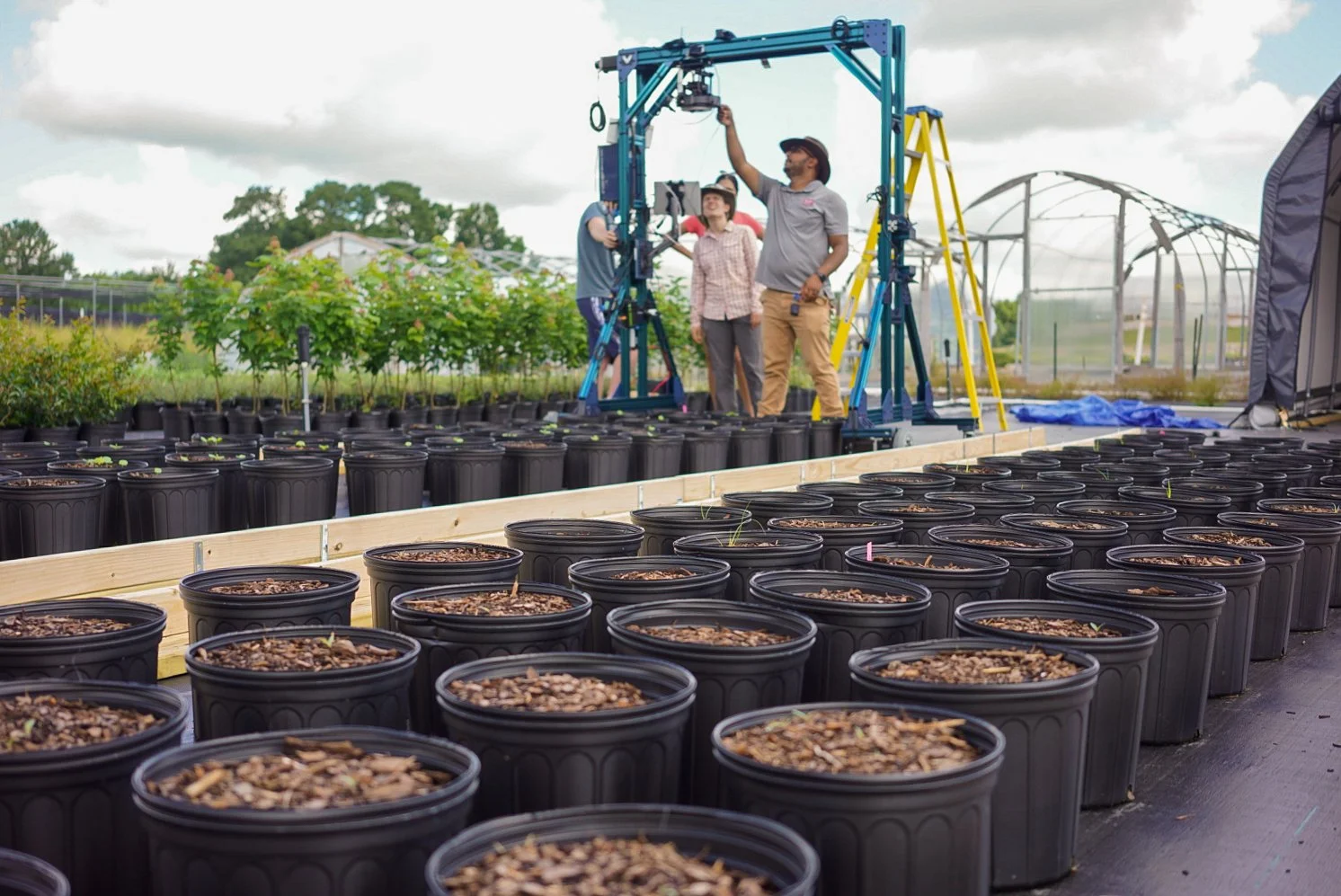
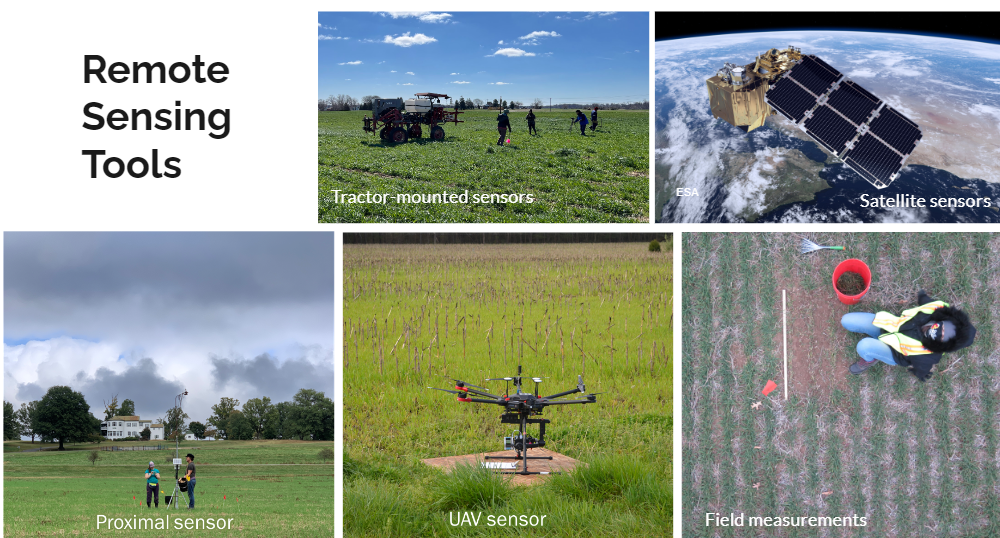
Remote Sensing
The Precision Sustainable Agriculture remote sensing team uses satellite, drone, tractor-mounted, and proximal (on-the-ground) sensors to investigate cover crops on farms. The team combines imagery and field data to better understand winter cover crop quantity and quality. These analyses can inform adaptive management regarding cover crop termination planning, fertilizer use, and herbicide use. On a broader scale, these analyses can reveal the impacts of federal and state cost-share programs that incentivize sustainable agriculture practices.
Forage Sensor Box
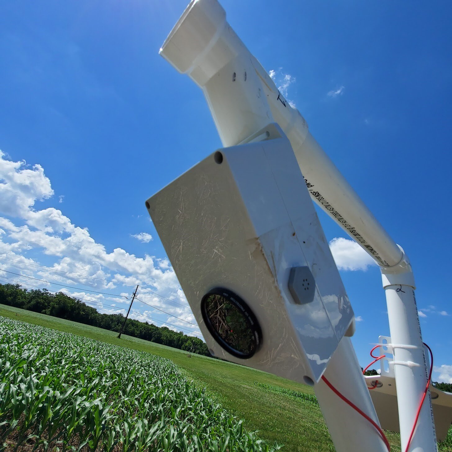
Precision Sustainable Agriculture’s Forage Sensor Box is a low-cost multi-sensor tool for mapping the biomass of cover crops. Farmers can mount it on a tractor to collect data while working in fields or attach it to a monopod to carry through fields. It has three sensors: two that use sound waves and lasers to quantify canopy height, and one that uses spectral technology to quantify the amount of green in a crop. In conjunction with satellite imagery, Forage Sensor Box pushes biomass estimations up to about 4,000 kg per hectare, which is much higher than what’s possible with multispectral satellites. Developed in collaboration with Holland Scientific, this sensor is commercially available as Crop Circle ACS-214 on Holland’s website and is being used by breeders and field scientists across the United States.
Watch this video to see PSA’s Forage Sensor Box.
HVCam
The High-Velocity Camera (HVCam) is a powerful research-grade camera that produces extremely high-resolution images. These images enable artificial intelligence (AI) and computer vision programs to identify classifications of weeds and cover crop mixes. Images taken by the HVCam can also be degraded to match the resolution of low-cost cameras, which are easily deployable on farms. [Why important that the resolution match?]
Watch this video to see PSA’s HVCam.
Gateway and Node Wireless Data Logging System
Precision Sustainable Agriculture’s Gateway and Node Wireless Data Logging System is a low-cost, open-source alternative to off-the-shelf systems. It continuously measures and records key variables over the growing season, including volumetric soil water content, soil temperature, and ambient temperature—at three soil depths. A radio network sends data from nodes in the field to a gateway at the field’s edge, reducing traffic in the field and the need for cellular service. The gateway sends data to the cloud, and password-protected software allows farmers and researchers to access an expansive data set for real-time decision making, model generation, and verification. OR …software integrates easily into user interfaces such as PSA’s Decision Support Tools [Which is better? Also, add link? or is this generic dsts?]
Watch this video to see the Gateway and Node Wireless Data Logging System.
Soil Moisture Technologies
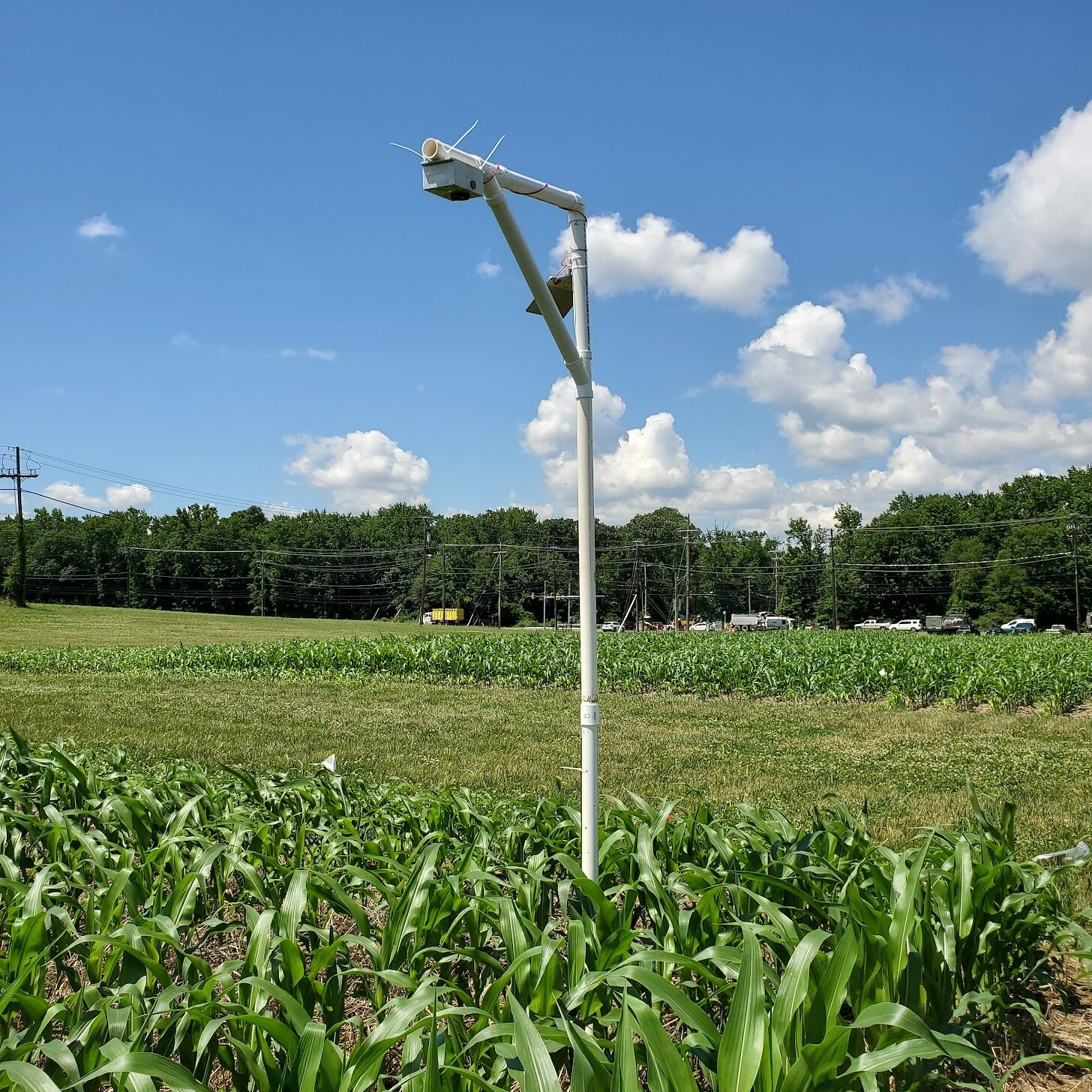
StressCam
Precision Sustainable Agriculture’s StressCam is an open-source, low-cost, stationary, continuous camera monitoring tool that integrates hardware and embedded machine learning algorithms to calculate the water stress in corn and soybeans. Using this technology, farmers have access to real-time drought detection and can assess the degree of water stress at any time during the growing season. Farms across the United States are using StressCam. [keep this? quantify, as in Water Sensors text?] Its hardware and software are publicly available through GitHub.
Water Sensors
Precision Sustainable Agriculture’s Water Sensors use cellular technology to collect soil water data throughout the growing season at four depths. PSA researchers collect these data remotely to make it available to farmers in near real time, to develop PSA’s Decision Support Tools and other agricultural technology, and to ensure that sensors are working properly. The Water Sensors are low cost and provide more flexible use than other available water sensors. To date, PSA has installed its Water Sensors on more than 220 farms in 20 states as part of its on-farm research network. [Still accurate?]
